Settled in 1788, Cincinnati is a major city in the U.S. state of Ohio and the government seat of Hamilton County. It is located at the northern side of the confluence of the Licking and Ohio rivers, the latter of which marks the state line with Kentucky.
Then-and-now Cincinnati
The city is the economic and cultural hub of the Cincinnati metropolitan area, the fastest growing economic power in the Midwestern United States based on increase of economic output. It is Ohio’s largest metropolitan area and the nation’s 29th-largest. Cincinnati is the third-largest city in Ohio and 64th in the United States.
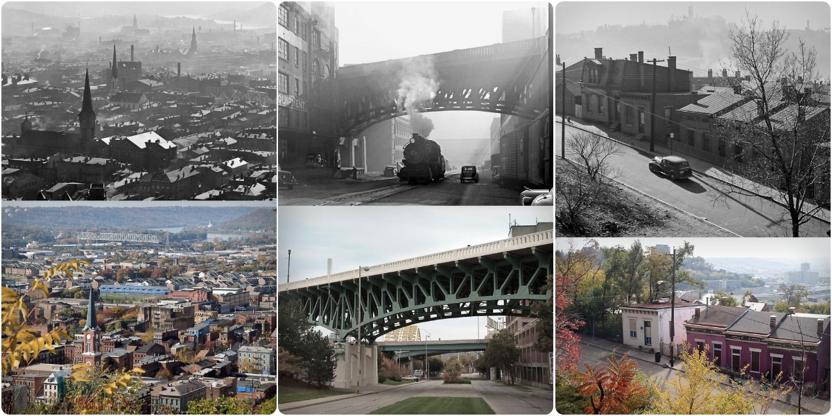
A series of photos from Michael G Smith taken between 1939 and 1941 by his grandfather Nelson Ronsheim compared with photos of the same location that he took in 2009. How much has Cincinnati changed in 70 years?
Looking east down Hill St. to the river over three generations. The two houses on the far right of the top photo are visible five houses in from the right of second photo (see key to right of photo). Original photo (top) taken April 1939 by Nelson Ronsheim (my grandfather). Second photo was taken about 1952 by Jerry Smith (my father) and bottom photo October 2009 by me, Michael Smith
Looking down Main St. from just above Seitz St. toward St. Peter German Evangelical Church on the right (now demolished). Cross street beyond lower steps is Mulberry; nearer cross street (mostly obscured by landing) is Seitz. The nearest building on the left (301 Seitz) and the turreted building on the right, just this side of the church, still stand. The stairs are located along the path of the Mt. Auburn Incline (demolished 1898). Original photo November 1941 by Nelson Ronsheim. 2009 photo by Michael G Smith
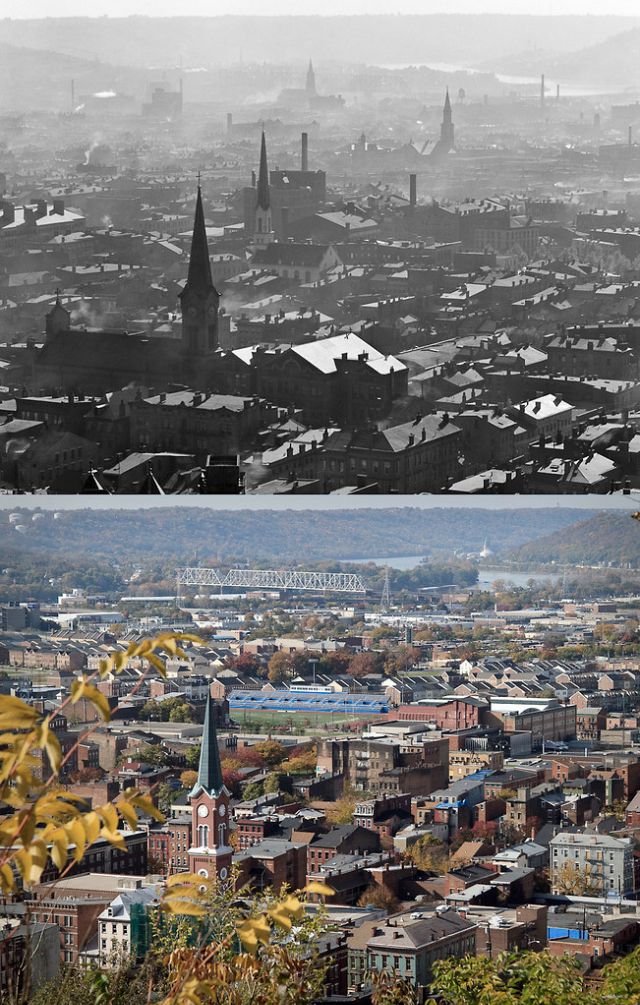
Cincinnati Over-the-Rhine; the nearest steeple is St. John Church. While the steeple still stands, the church is gone. St. Matthew’s Church at W. Liberty and Elm Street, visible beyond St. John, is long gone. Photographed Septembe 1940 from Jackson Hill Park by Nelson Ronsheim. This photo was an award winner at the 1940 Master Photo Finishers of America International Exhibition in Chicago. 2009 photo by Michael G Smith
Cinncinnati and Over-the-Rhine from the vicinity of the Walker St. dead end. Salem United Church of Christ is nearest, then Old St. Mary’s Church. Original photo by Nelson Ronsheim October 1940. 2009 photo by Michael G Smith
Laurel St. (now Ezzard Charles) looking west toward Union Terminal. Original photo April 1939 by Nelson Ronsheim. 2009 photo by Michael G Smith


Leave a Reply